
I’m guessing that I’m not the only walker to have trekked far from home, yet sadly ignored the countryside at my front step (writes Country Walking features editor Jenny Walters). I know more about the routes up Snowdon or New Zealand’s Milford Track than about a footpath a mile from my house.
nd so my Walk Every Path project was hatched. The idea was simple: to explore every Right of Way on an Ordnance Survey map, a custom-made, aptly-named Explorer with my house at its centre. When the map plonked through my door, I couldn’t wait to unfold it: every centimetre of green-dash path and bridleway on the paper representing 250m of ground I would explore. I’d walked some already – almost worn a groove on a four-mile loop through my local woods – but the fields, forests, villages and rivers beyond were a world unknown.
I began walking the map last winter, as the nights drew in and I was loath to spend the day driving a hundred miles to my nearest national park in time for dusk. The map extended 10km to north, south, east and west and the furthest corner was just 14km from my village, a tiny place between Peterborough (home of Country Walking) and Corby.
It’s not the sort of landscape you find celebrated on decorative tablemats, and it’s not the sort that makes people coo ‘wow’ at first sight. Yet I soon found interesting places, even a couple that attracted tourists by the busload. I walked to the oak-leaf symbol of the National Trust and saw the unfinished Elizabethan summerhouse of Lyveden New Bield, ventured to the blue bird that marks a nature reserve and explored the ancient woodlands of the Bedford Purlieus, and strolled to the tankard symbol of the King’s Arms in Polebrook and discovered its delicious paella.

And I liked how the world around me started to fit together. A single walk can sometimes give just a quick sketch of a place, but these footpaths gradually built into an intricate painting, each expedition adding colour and texture to the picture. I started to warm to the gentle Northamptonshire countryside, to appreciate the beauty of the quiet farms and amber-stoned villages and patches of woodland, the church steeples and towers that added verticals to the lightly contoured fields.
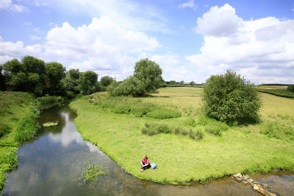
And with no epic sweep of rugged panorama to draw my eye, I began to notice the scenery close up, to pause and admire the curling bloom of a single English bluebell, watch the twinkling scissor wings of a dragonfly, sit on a log and listen to the ocean sigh of the breeze in the pines and the clatter of squirrel claws racing along branches.
It wasn’t all happy wandering, though. I got lost. I was chased by dogs. I screamed my throat hoarse with rage on a summer stroll of impenetrable stinging nettles, broken stiles, fields of tetchy bulls, and footpaths that drowned in reedbeds.
Each time I made it home I’d indulge my inner geek and wield my lime-green highlighter pen, merrily marking off the paths I’d walked. After a while, I started crossing off grid squares where I’d explored every path and that’s when the scale of the project really dawned. I’d walked for many, many happy hours, and had only completed half of my map’s four hundred squares.
It was a reminder of the grand scale of our rights of way network, the miles of footpath that wander from village to village across the whole of the country. Close study also revealed the randomness of some of those paths, strange snippets of walkway that possibly once had a point but now link nothing to nowhere. To properly finish this challenge I’ll have to spend a day in the car, parking up on a verge and ticking off bits of path that lead 43 metres to the middle of a field and stop.

I started in winter but the project has kept me out exploring all year, walking this patch of England through all the seasons. I was overjoyed when the waterlogged chilliness burst into the bright shades of an early spring and I heard a nightingale singing in the woods. I watched the summer greens turn gold and listened to the wheat pop in the sunshine as I walked through ripening crops. In autumn, I heard the brooks burble back into rain-fed life, and saw ploughed and sprouting fields rippled like shot velvet, before that soft rain glued footballs of mud to my boot soles.
This Walk Every Path project will keep me going into next year too, and with a new custom-made map in my hand. My hailed-on, dropped-in-muck, hurled-into-brambles-in-anger original started to look a bit ragged, and then one day I walked across a field and happened across a lake – a lake – that wasn’t on it. It was proof that the landscape is always changing and that I needed an up-to-date map.
And every walk feels like it forges a new link between me and the land, building knowledge and memories that make it feel like my home. I can picture the path across the fields to the River Nene, identify the best spot to watch lapwings skydancing in spring, and I know where to find the best slice of cake on the map (The Old Barn in Wadenhoe, if you’re interested). And unlike the Munros, the Wainwrights, the Corbetts or Marilyns, this is a challenge on the doorstep of every walker. Just one map and the world at your doorstep is yours to explore.
START YOUR OWN ADVENTURE
You can order your own Ordnance Survey Custom-Made Map with your house at its heart for £16.99, including free delivery.
Or you can use a Country Walking subscription to get a year's free access (worth £23.99) to printable OS maps at up to A3 size.